Groups are an opportunity to share information and resources with like-minded ocean users. Create or join a map group that interests you — and invite your colleagues! Maps and drawings can be saved and shared through your group with other registered Portal users.
*Note: The OROWind administrators reserve the right to review and remove Groups and content shared within them due to inactivity, inappropriate content or other misuse.
Member Groups
Demo
This group is a place to share example maps and drawings that demonstrate the use of those features and the group feature of OROWindMap. Use this group to get familiar with your options, and then create your own public or private groups to collaborate with others and share your own maps and drawings!
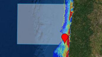
OSW Assessment Maps
Assessment of Call Areas and WEAs.

Public Map Gallery
A group for users of the OROWinMap Tool to share maps of their own making in a public gallery.
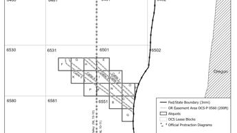
BOEM Oregon OSW
For Frank and Whitney B. to look at Oregon datasets
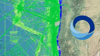
Albacore Tuna
This group will contain data pertaining to the Albacore tuna fishery off the Oregon coast. Data will include recent fishing effort, outcome, sea conditions, and other elements that will be useful to members. The data will be shared with all group members. By joining this group you agree to the terms and privacy policy. The Group owner will grant access upon request and have the rights to terminate access to violators.
Terms:
Be respectful, Be courteous and please contribute.